
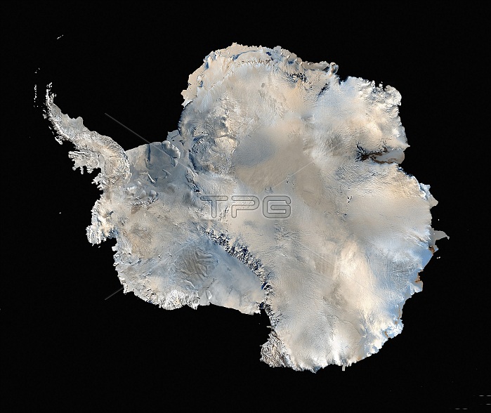
The world's first high resolution, three-dimensional, true-color map of Antarctica was built from more than 1,100 images from the Landsat 7 satellite. To create the Landsat Image Mosaic of Antarctica (LIMA), scientific visualizers combined Landsat 7 scenes (acquired between 1999 and 2001), a digital elevation model, and field data measurements. It took years to stitch the whole thing together for release in 2007. NASA worked with the USGS, the National Science Foundation, and the British Antarctic Survey to create the map of the highest, driest, coldest, windiest, and brightest of Earth's seven continents. The composite, continental view and all the individual scenes in it are now available on the Internet, free of charge. Landsat 7, launched on April 15, 1999, is the seventh satellite of the Landsat program. Landsat 7's primary goal is to refresh the global archive of satellite photos, providing up-to-date and cloud-free images. The Landsat Program is managed and operated by the USGS, and data from Landsat 7 is collected and distributed by the USGS.
| px | px | dpi | = | cm | x | cm | = | MB |
Details
Creative#:
TOP22315072
Source:
達志影像
Authorization Type:
RM
Release Information:
須由TPG 完整授權
Model Release:
N/A
Property Release:
No
Right to Privacy:
No
Same folder images:
 Loading