
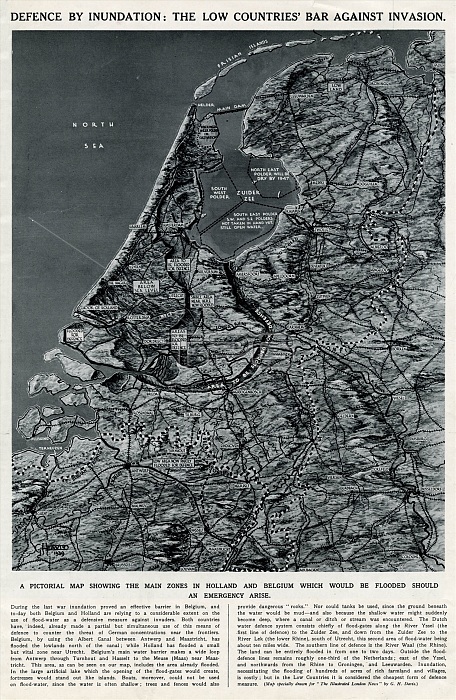
Defence by inundation: the Low Countries' bar against invasion. A pictorial map drawn in the early weeks of the Second World War, showing the main zones in Holland and Belgium which would be flooded should an emergency arise.
| px | px | dpi | = | cm | x | cm | = | MB |
Details
Creative#:
TOP23847503
Source:
達志影像
Authorization Type:
RM
Release Information:
須由TPG 完整授權
Model Release:
No
Property Release:
No
Right to Privacy:
No
Same folder images:
 Loading