
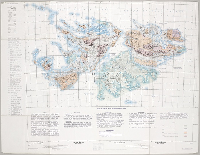
Falkland Islands Royal Engineer briefing map, 1982 (c); with typescript annotations relating to the condition and passibility of airfields, roads and tracks by tracked and wheeled vehicles. From papers relating to the South Atlantic (Falklands War) (1982), collected by 24057159 WO2 David Langham, 81 Ordnance Company, Royal Army Ordnance Corps.
| px | px | dpi | = | cm | x | cm | = | MB |
Details
Creative#:
TOP23968958
Source:
達志影像
Authorization Type:
RM
Release Information:
須由TPG 完整授權
Model Release:
No
Property Release:
No
Right to Privacy:
No
Same folder images:
 Loading