
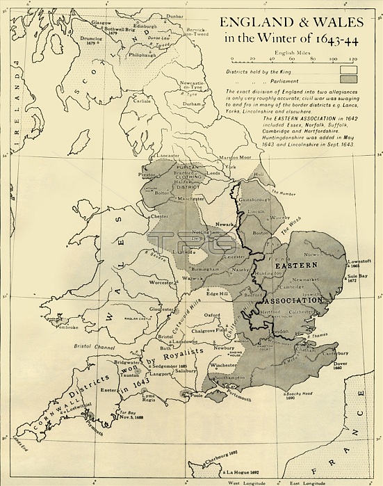
'England & Wales in the Winter of 1643-44', 1926. Map showing England and Wales during the Civil War period. The key shows districts held by the king (Charles I), and by parliament. 'The exact division of England into two allegiances is only very roughly accurate; civil war was swaying to and fro in many of the border districts eg Lancashire, Yorkshire, Lincolnshire and elsewhere. The Eastern Association in 1642 included Essex, Norfolk, Suffolk, Cambridge and Hertfordshire. Huntingdonshire was added in May 1643 and Lincolnshire in September 1643.' From "History of England", by George Macaulay Trevelyan. [Longmans, Green and Co. Ltd, London, 1926]
| px | px | dpi | = | cm | x | cm | = | MB |
Details
Creative#:
TOP24718488
Source:
達志影像
Authorization Type:
RM
Release Information:
須由TPG 完整授權
Model Release:
No
Property Release:
No
Right to Privacy:
No
Same folder images:
 Loading