
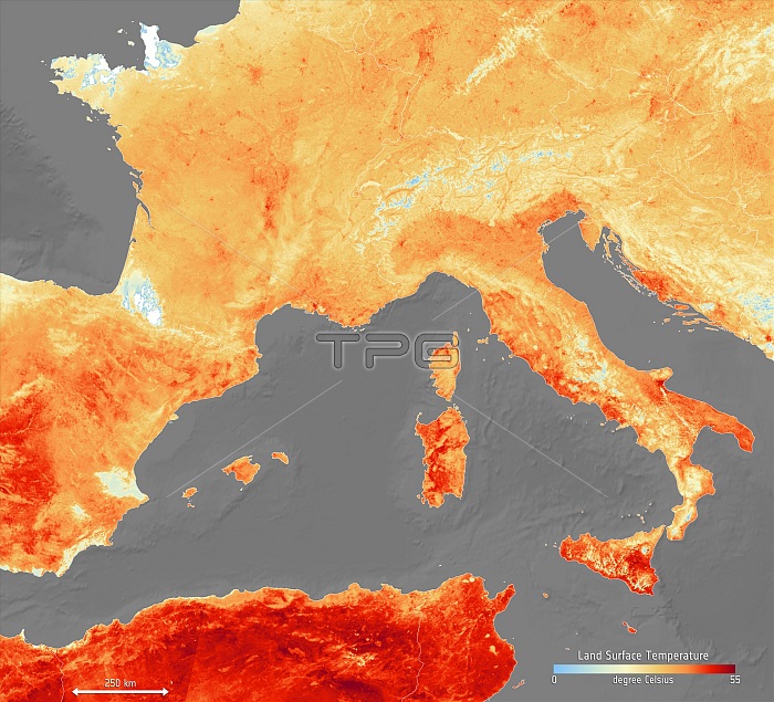
European heatwave, 2019. Satellite image showing the land surface temperatures over parts of Europe and North Africa on 26th June 2019. White areas were obscured by cloud and light blue areas are covered with snow. On 26th June the June temperature record was broken in Germany, and on the 28th June France recorded its highest temperature ever at 45.8 degrees Celsius. Wild fires caused by the heatwave in Catalonia, Spain, were the worst for 20 years. The heatwave was caused by hot air drawn from North Africa. Data obtained by the Sea and Land Surface Temperature Radiometer on the European Space Agency's (ESA) Copernicus Sentinel-3 satellite.
| px | px | dpi | = | cm | x | cm | = | MB |
Details
Creative#:
TOP24755225
Source:
達志影像
Authorization Type:
RM
Release Information:
須由TPG 完整授權
Model Release:
N/A
Property Release:
N/A
Right to Privacy:
No
Same folder images:
 Loading