
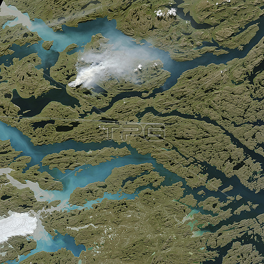
Wildfire in Greenland in August 2017, satellite image. This sizable wildfire (smoke at upper left) burned along Greenland's coast in August 2017. The fire (which appears to be fuelled by peat) burned in western Greenland, about 150 kilometres north-east of Sisimiut. A dry summer made the vegetation here more prone to fires. Satellites first detected evidence of the fire on 31 July 2017. This image was obtained on 3 August 2017 by the Operational Land Imager (OLI) on the Landsat 8 satellite.
| px | px | dpi | = | cm | x | cm | = | MB |
Details
Creative#:
TOP25529483
Source:
達志影像
Authorization Type:
RM
Release Information:
須由TPG 完整授權
Model Release:
N/A
Property Release:
N/A
Right to Privacy:
No
Same folder images:
 Loading