
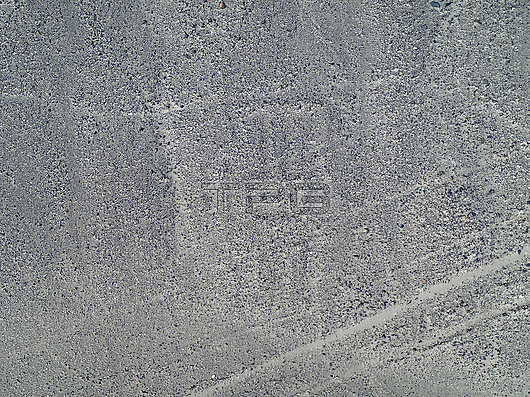
IBM research on Nazca Lines. Aerial photograph of an example of Nazca Lines, uncovered by IBM research using artificial intelligence (AI) and geospatial data. Nazca Lines are ancient geoglyphs (landscape drawings) in the Nazca Desert of southern Peru. These geoglyphs cover huge areas and can only be properly seen from the air. For a drawing of this geoglyph, see image C048/5623. The Nazca Lines were made by removing the dark surface stone to reveal a lighter stone layer underneath. They are thought to have been made by the Nazca, a native South American people, between around 400 and 650 AD. Theories about the lines have ranged from uses in astronomy (for seasonal agriculture) to ceremonial uses in religion. This example was discovered using IBM Watson Machine Learning Accelerator on IBM Power Systems. Image published in November 2019.
| px | px | dpi | = | cm | x | cm | = | MB |
Details
Creative#:
TOP25642952
Source:
達志影像
Authorization Type:
RM
Release Information:
須由TPG 完整授權
Model Release:
N/A
Property Release:
N/A
Right to Privacy:
No
Same folder images:
 Loading