
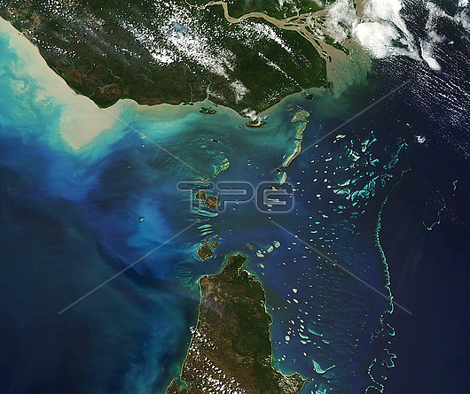
Satellite image of the Torres strait, separating Australia (bottom) and Papau New Guinea (top). The strait measures 150 kilometres. Image obtained by Moderate Resolution Imaging Spectroradiometer (MODIS) on NASA?檚 Aqua satellite on 10th August 2018.
| px | px | dpi | = | cm | x | cm | = | MB |
Details
Creative#:
TOP26624149
Source:
達志影像
Authorization Type:
RM
Release Information:
須由TPG 完整授權
Model Release:
N/A
Property Release:
N/A
Right to Privacy:
No
Same folder images:
 Loading