
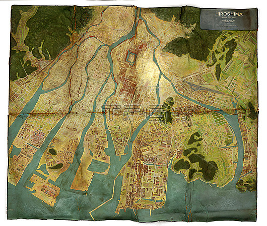
Topographical map of Hiroshima, Japan, made for the United States Strategic Bombing Survey (USSBS). The map was created after a US bomber dropped the Little Boy atomic bomb on the city on 6th of August 1945. The bomb caused enormous destruction: killing over 140,000 people. The USSBS report was produced to study the aerial effects of bombing carried out in German-occupied Europe and Japan during World War Two, as well as for the strategic future planning of the armed forces.
| px | px | dpi | = | cm | x | cm | = | MB |
Details
Creative#:
TOP26811590
Source:
達志影像
Authorization Type:
RM
Release Information:
須由TPG 完整授權
Model Release:
N/A
Property Release:
N/A
Right to Privacy:
No
Same folder images:
 Loading