
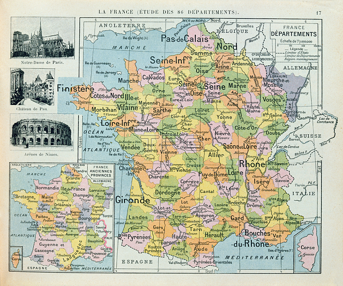
CHT391149 Map of France, c. 1914 (colour litho) by French School, (20th century); Private Collection; (add.info.: map shows the French Departments before the 1st World War with Alsace-Lorraine coloured purple; carte des departements Francais avec la tache noire d\'Alsace-Lorraine; from a school atlas; also depicts the former provinces of France;); 穢 Archives Charmet; French, out of copyright.
| px | px | dpi | = | cm | x | cm | = | MB |
Details
Creative#:
TOP26922661
Source:
達志影像
Authorization Type:
RM
Release Information:
須由TPG 完整授權
Model Release:
No
Property Release:
No
Right to Privacy:
No
Same folder images:
 Loading