
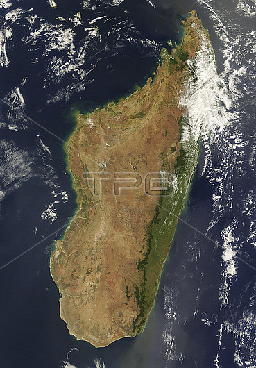
Satellite image of Madagascar, an island in the Indian Ocean located 400 kilometres off the east coast of Africa. Small red dots on the image are used to show active fires: controlled burns used to clear farmland. Madagascar's east coast is lined with rainforest. whilst the west coast has many boabab trees and thorny forest. Image obtained by Moderate Resolution Imaging Spectroradiometer (MODIS) on NASA?檚 Terra satellite on 10th September 2020.
| px | px | dpi | = | cm | x | cm | = | MB |
Details
Creative#:
TOP27328208
Source:
達志影像
Authorization Type:
RM
Release Information:
須由TPG 完整授權
Model Release:
N/A
Property Release:
N/A
Right to Privacy:
No
Same folder images:
 Loading