
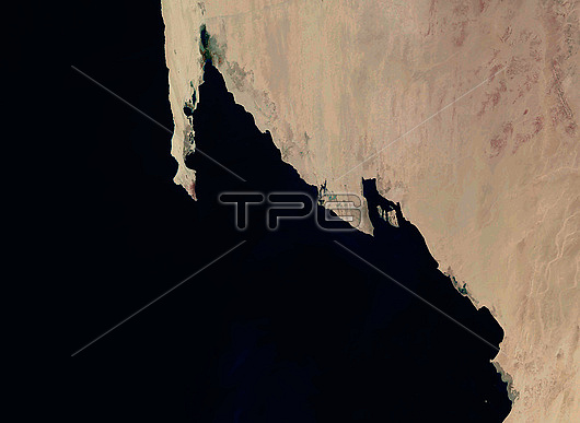
Satellite image of part of the coast of Mauritania in northwest Africa. At top left is the Ras Nouadhibou peninsula, which is 60 kilometres long and is divided between Mauritania and Western Sahara. The land at right, from roughly in line with the end of Ras Nouadhibou downwards, is part of Banc d'Arguin National Park, which is a major breeding site for migratory birds. Data obtained by the Landsat 8 satellite between 2nd and 13th January 2022.
| px | px | dpi | = | cm | x | cm | = | MB |
Details
Creative#:
TOP27383412
Source:
達志影像
Authorization Type:
RM
Release Information:
須由TPG 完整授權
Model Release:
N/A
Property Release:
N/A
Right to Privacy:
No
Same folder images:
africaafricanarguinatlanticoceanbancd'arguinnationalparkbayofarguinbordercapblanccoastcoastalcoastlinecountryfromspacegeographicalgeographyheadlandislamicrepublicofmauritaniaislandmauritanianaturereserveno-onenobodypeninsularasnouadhibousatelliteimagetidrawestwesternwesternsaharalandsat8satellitejanuary2022
82022africaafricanarguinarguinatlanticbancbayblancbordercapcoastcoastalcoastlinecountryd'arguinfromgeographicalgeographyheadlandimageislamicislandjanuarylandsatmauritaniamauritanianationalnatureno-onenobodynouadhibouoceanofofparkpeninsularasrepublicreservesaharasatellitesatellitespacetidrawestwesternwestern
 Loading