
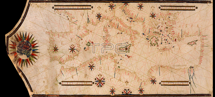
3507730 Portolan Map of the Mediterranean and connecting seas, 1754; (add.info.: Portolan Map of the Mediterranean and connecting seas. Portolan or portulan charts are navigational maps based on compass directions and estimated distances observed by the pilots at sea. They were first made in the 13th century in Italy, and later in Spain and Portugal, with later 15th and 16th century charts noted for their cartographic accuracy. With the advent of widespread competition among seagoing nations during the Age of Discovery, Portugal and Spain considered such maps to be state secrets.); Universal History Archive; out of copyright.
| px | px | dpi | = | cm | x | cm | = | MB |
Details
Creative#:
TOP27575614
Source:
達志影像
Authorization Type:
RM
Release Information:
須由TPG 完整授權
Model Release:
No
Property Release:
No
Right to Privacy:
No
Same folder images:
 Loading