
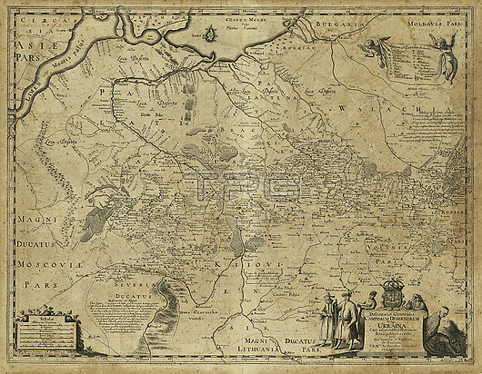
Map showing Ukraine, and adjacent provinces of the royal Kingdom of Poland by French-Polish cartographer Guillaume Le Vasseur de Beauplan and published in 1648.
| px | px | dpi | = | cm | x | cm | = | MB |
Details
Creative#:
TOP27682629
Source:
達志影像
Authorization Type:
RM
Release Information:
須由TPG 完整授權
Model Release:
N/A
Property Release:
N/A
Right to Privacy:
No
Same folder images:
 Loading