
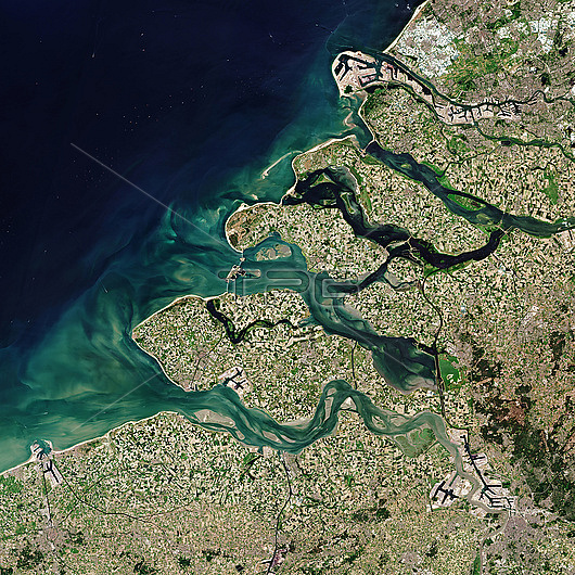
Copernicus sentinel-2 satellite image of Zeeland, Netherlands, the westernmost province in the Netherlands. The province lies on a river delta situated at the mouth of the Schedlt, Meuse and Rhine. The light aqua colours are shallow waters of the delta with riverbeds and several sandbanks visible. The brown colour shows areas of higher sediment content. Rotterdam Europe's largest seaport is seen at the top right. Antwerp (bottom left) and Bruges (bottom right) in Belgium are also seen. Photographed on the 30th of May 2020.
| px | px | dpi | = | cm | x | cm | = | MB |
Details
Creative#:
TOP28042391
Source:
達志影像
Authorization Type:
RM
Release Information:
須由TPG 完整授權
Model Release:
N/A
Property Release:
N/A
Right to Privacy:
No
Same folder images:
Restriction:
This image may not be used to state or imply ESA endorsement of any company or product
 Loading