
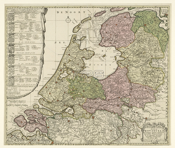
Map of the Republic of the Seven United Netherlands; the Caerte Country of the United Netherlands; with the rest of the subject; divided into syn Provincia / Exactissima Belgium Foederati Tabula cum annexis divisa in Provincias ..; Map of the Republic with on the left the arms of the seven provinces with per province a subdivision into regions; numbers of cities; villages; vlecken; lands of the knights; cities; academies and colleges of Admiralty. Flanders has been added to the description; but without a weapon. Bottom right a cartouche with the title in Latin. The seven provinces are colored differently; the other areas are left uncoloured; maps of separate countries or regions; coat of arms (as symbol of the state; etc.) (province; provincial); Netherlands; Republic of the Seven United Netherlands; Caspar Specht (possibly); 1702 and/or 1726 - 1750; paper; engraving; h 510 mm x w 600 mm
| px | px | dpi | = | cm | x | cm | = | MB |
Details
Creative#:
TOP28295362
Source:
達志影像
Authorization Type:
RM
Release Information:
須由TPG 完整授權
Model Release:
No
Property Release:
No
Right to Privacy:
No
Same folder images:
 Loading