
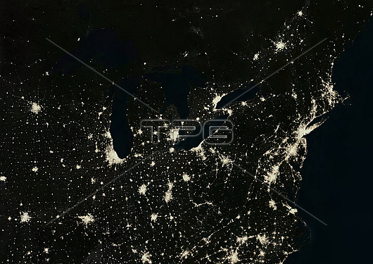
Colour satellite image of The Northeast America at night, USA, showing the Great Lakes and Northeast Regions of the USA and Canada. This image was compiled from data acquired in 2016 by Landsat satellites.
| px | px | dpi | = | cm | x | cm | = | MB |
Details
Creative#:
TOP28927019
Source:
達志影像
Authorization Type:
RM
Release Information:
須由TPG 完整授權
Model Release:
n/a
Property Release:
n/a
Right to Privacy:
No
Same folder images:
 Loading