
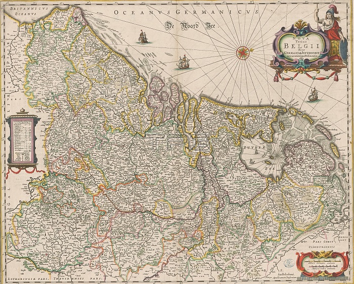
Map of the Seventeen Provinces, Nova totius Belgii sive Germaniae Inferioris accuratissima delineatio (title on object), On the left a cartouche with an overview of the provinces, topographical information and a legend. Top right title cartouche, to its left Minerva is depicted. Bottom right scale bar: Milliaria Germanica communia, Milliaria Gallica communia. Degree divisions along the edges. Orientation: north right. On verso Latin text in letterpress, title: Germania Inferior sive Belgica hodierna. print maker: anonymous, publisher: Johannes Janssonius, (rejected attribution), publisher: Johannes Janssonius van Waesberge (I), Amsterdam, 1661 and/or in or after 1666, paper, engraving, letterpress printing, height 447 mm x width 552 mm.
| px | px | dpi | = | cm | x | cm | = | MB |
Details
Creative#:
TOP28937999
Source:
達志影像
Authorization Type:
RM
Release Information:
須由TPG 完整授權
Model Release:
No
Property Release:
No
Right to Privacy:
No
Same folder images:
 Loading