
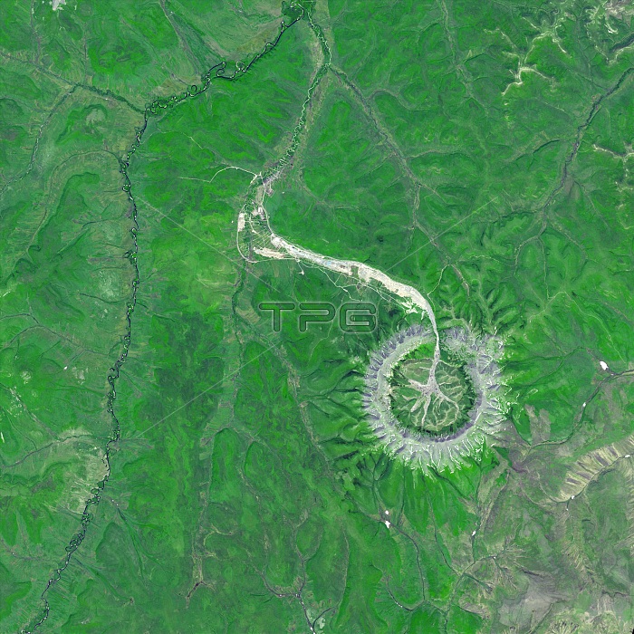
Kondyor Massif, Khabarovsk Krai, Russia, composite satellite image. This circular rock formation is called an intrusion. It forms when the molten magma of igneous rock crystallises below the Earth's surface and is slowly pushed up through the mantle, a process that can take over a billion years. The Kondyor Massif intrusion has slowly made its way through over 8000 km of mantle and is now visible on the surface of the Earth. The circular ring of rock is bare but vegetation can be found inside the circle (bright green). A river flows out from its centre on the north side, fuelled by snow melt from the 610-metre high rim collecting in the middle. The Kondyor Massif is also mineral rich, with gold, silver, and platinum among the highly valued minerals present. This 3D view was made by draping Advanced Spaceborne Thermal Emission and Reflection Radiometer (ASTER) image data over ASTER-derived topography data. Image obtained on 10th June 2006 by ASTER on the Terra satellite.
| px | px | dpi | = | cm | x | cm | = | MB |
Details
Creative#:
TOP29028041
Source:
達志影像
Authorization Type:
RM
Release Information:
須由TPG 完整授權
Model Release:
Not Available
Property Release:
Not Available
Right to Privacy:
No
Same folder images:
 Loading