
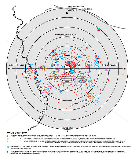
Iron distribution map for Barringer Crater, Arizona, USA, also known as Meteor Crater. A 9.65 kilometre radius circle, centred on the crater, was investigated from 1903 to 1905 by the US mining engineer and businessman Daniel Barringer (1860-1929). He mapped the meteoric iron deposits (five types listed in the key at bottom) and was the first to suggest that the crater was created by a meteor impact. Barringer had formed the Standard Iron Company to mine the area, and spent 27 years trying to find the remnant of the meteor, but it had mostly vaporized on impact. Several geographical features are also shown on the map.
| px | px | dpi | = | cm | x | cm | = | MB |
Details
Creative#:
TOP29699255
Source:
達志影像
Authorization Type:
RM
Release Information:
須由TPG 完整授權
Model Release:
N/A
Property Release:
N/A
Right to Privacy:
No
Same folder images:
 Loading