
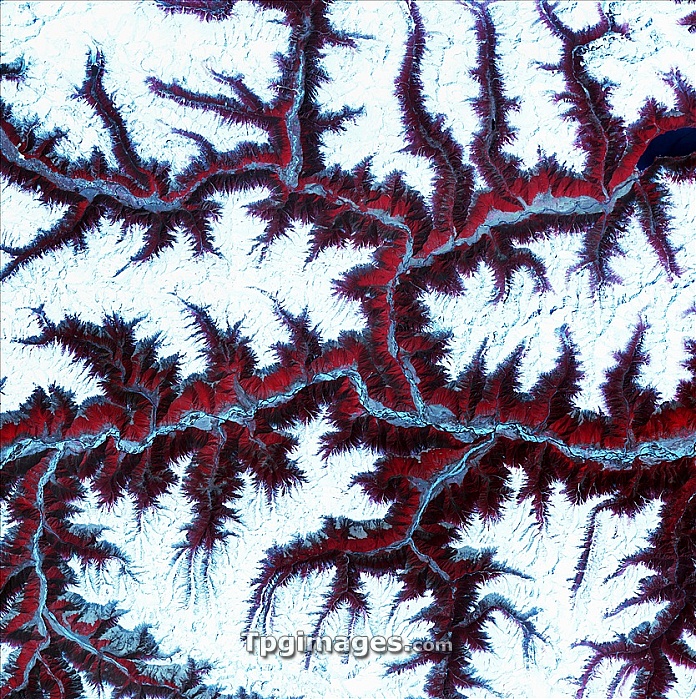
Eastern Himalayas, satellite image. North is at top. Snow is white, vegetation is red, barren areas are light blue and water is dark blue. This is a region of the eastern Himalayas, in China, north-east of Bhutan. The landscape consists of soaring mountains, with snow-capped peaks and vegetation on the lower slopes. Major rivers run through the valleys, fed by glacial meltwater. The barren areas (light blue) are where sediment has been deposited by the rivers. The area shown in this image is around 60 kilometres wide. The image data includes infrared wavelengths, and was obtained on 17 February 2002, using the ASTER sensor on the Terra satellite.
| px | px | dpi | = | cm | x | cm | = | MB |
Details
Creative#:
TPG05323703
Source:
達志影像
Authorization Type:
RF
Release Information:
須由TPG 完整授權
Model Release:
NO
Property Release:
NO
Right to Privacy:
No
Same folder images:
 Loading