
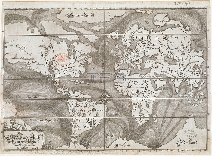
A map showing ocean currents as understood at the time; based on the observations of explorers and mariners.Ulm; 1687.From: Die Ebbe und Fluth auff einer flachen Landt-Karten f黵gestelt.Maps. 974. (4)London; British Library.
| px | px | dpi | = | cm | x | cm | = | MB |
Details
Creative#:
TOP20985601
Source:
達志影像
Authorization Type:
RM
Release Information:
須由TPG 完整授權
Model Release:
No
Property Release:
No
Right to Privacy:
No
Same folder images:
Restriction:
Additional permissions needed for non-editorial use.
 Loading