
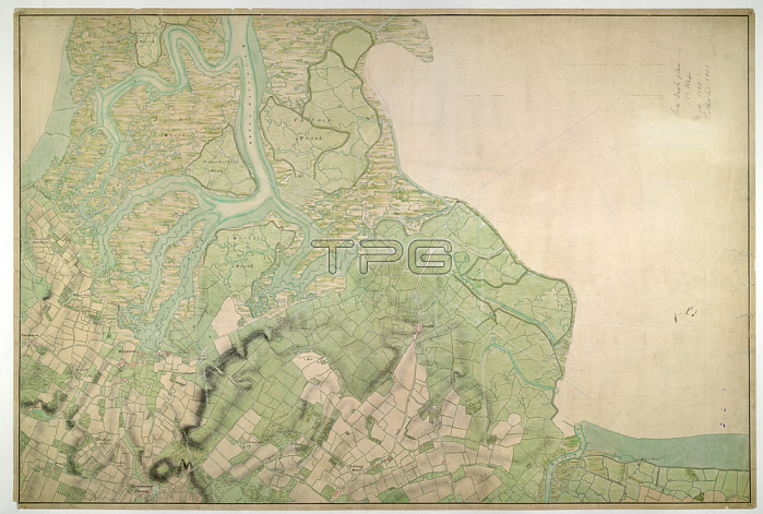
Halstow (Kent). Drawing showing the area around Halstow in Kent. This map is drawn on rectangular sheet lines; enclosed by a black border. Fields are coloured brown where cultivated; and green or blank if untilled. Marshland dominates this estuarine landscape and is depicted by symbols with three vertically inclined strokes above a short horizontal line. Stonework buildings or structures are drawn in red ink at settlements such as Iwade and Halstow at the centre of the plan. Ruled pencil rays intersect the map; evidence of angular measurements taken by the surveyor between fixed triangulation points. Altitudes (鈥榮pot heights') are measured and noted in red-ink figures.1797.OSD 114London; British Library.
| px | px | dpi | = | cm | x | cm | = | MB |
Details
Creative#:
TOP21004288
Source:
達志影像
Authorization Type:
RM
Release Information:
須由TPG 完整授權
Model Release:
No
Property Release:
No
Right to Privacy:
No
Same folder images:
Restriction:
Additional permissions needed for non-editorial use.
 Loading