
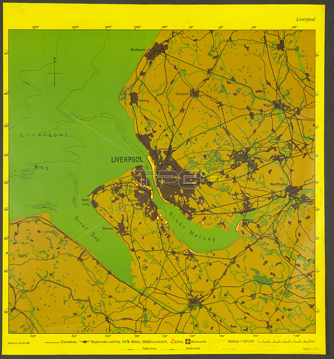
This German map of Liverpool dates back to the Second World War. It is one of a series of maps used by German bomber pilots in their night-time missions over Britain. Only the most obvious features are included on the map: towns; railway lines; major roads; woodland etc. The map's bright colours helped the pilots to pick out details at night - remember pilots would have had to read the maps in dark aeroplanes. German bombing map of Liverpool; 1941Note the areas marked in red and yellow. These were the target areas for the mission. Dock areas such as Portsmouth and Southampton were regular targets for the German Airforce; and were heavily bombed during the course of the war. On this map; the yellow circle surrounding the area just outside Oldham; is marked with the words 鈥楢chtung. Deutsches Gefangenenlager in Oldham-Leeds'. This alerted the bomber pilots to a prisoner of war camp which was holding German soldiers - obviously an area that was to be avoided during the mission.[Berlin?]: [Generalstab des Luftwaffe?]; 1941.From: [Great Britain bombing maps].Maps. Y. 415London; British Library.
| px | px | dpi | = | cm | x | cm | = | MB |
Details
Creative#:
TOP21004292
Source:
達志影像
Authorization Type:
RM
Release Information:
須由TPG 完整授權
Model Release:
No
Property Release:
No
Right to Privacy:
No
Same folder images:
Restriction:
Additional permissions needed for non-editorial use.
 Loading