
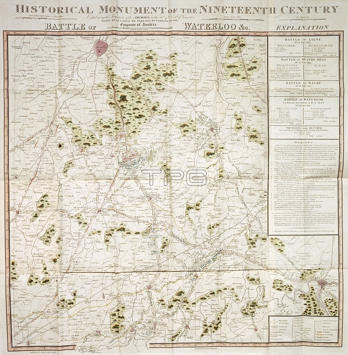
Map of the Waterloo campaign, 1815, Walmer Castle, Kent. Map Exhibiting the Situation of the Armies on the 16, 17 & 18 of June 1815. The Battle of Ligny, Quatre Bras, Waterloo and Wavre.
| px | px | dpi | = | cm | x | cm | = | MB |
Details
Creative#:
TOP21797730
Source:
達志影像
Authorization Type:
RM
Release Information:
須由TPG 完整授權
Model Release:
No
Property Release:
No
Right to Privacy:
No
Same folder images:
buildingbuildingscountryFrenchFranceBritishBelgiumcastlecolorcolourfortificationmilitarywarlocationcenturyBritainconceptbattleArmywarfarecampaign19thcenturyPrussiannineteenthcenturyEnglishHeritageBattleofWaterlooNapoleonicWarsPrussiaTGNWalmerCastleBattleofQuatreBrasEnglishHeritagemapBattleofLignyDukeofArthurDukeofWellingtonWellingtonWellesleyArthurWellesley1stDukeofWellingtonTheIronDukeIronDukeNapoleonBonaparteIBonaparteLordWellington1stDukeofWellingtonSirArthurWellesleyBattleofWavre
19th1st1stArmyArthurArthurArthurBattleBattleBattleBattleBelgiumBonaparteBonaparteBrasBritainBritishCastleDukeDukeDukeDukeDukeDukeEnglishEnglishFranceFrenchHeritageHeritageIIronIronLignyLordNapoleonNapoleonicPrussiaPrussianQuatreSirTGNTheWalmerWarsWaterlooWavreWellesleyWellesleyWellesleyWellingtonWellingtonWellingtonWellingtonWellingtonbattlebuildingbuildingscampaigncastlecenturycenturycenturycolorcolourconceptcountryfortificationlocationmapmilitarynineteenthofofofofofofofofwarwarfare
 Loading