
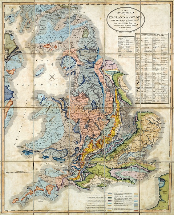
First geological map of Britain, 1824 edition. This map was first published in 1815 by British geologist William Smith (1769-1839). It shows rock layers (strata) in England and Wales and part of Scotland (keys at lower right and upper right). Smith's work as a canal surveyor allowed him to study geology. He discovered that geological strata could be reliably identified at different places on the basis of the fossils they contained. Smith also proposed the principle of superposition, that if a strata overlays another then it was laid down at a later time. He is considered the father of English geology. The full title of the map is: 'A new geological map of England and Wales with the inland navigations, exhibiting the districts of coal and other sites of mineral tonnage'.
| px | px | dpi | = | cm | x | cm | = | MB |
Details
Creative#:
TOP25354387
Source:
達志影像
Authorization Type:
RM
Release Information:
須由TPG 完整授權
Model Release:
N/A
Property Release:
N/A
Right to Privacy:
No
Same folder images:
 Loading