
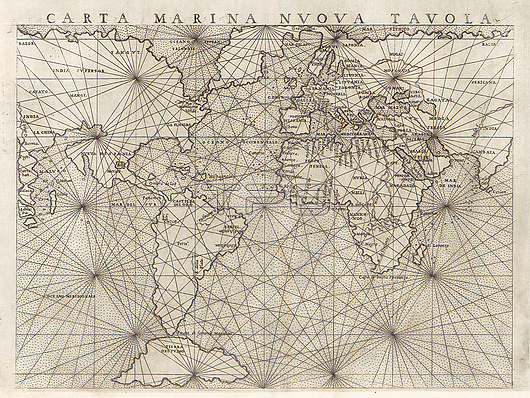
16th century global maritime map by Italian cartographer Giacomo Gastaldi (c.1500-1566) entitled 'Carta Marina Nuova Tavola'. The map shows the continents connected together, relying on the idea by mathematician Ptolemy (100-170 AD) of interconnected landmasses. Published in 1561.
| px | px | dpi | = | cm | x | cm | = | MB |
Details
Creative#:
TOP26538068
Source:
達志影像
Authorization Type:
RM
Release Information:
須由TPG 完整授權
Model Release:
N/A
Property Release:
N/A
Right to Privacy:
No
Same folder images:
 Loading