
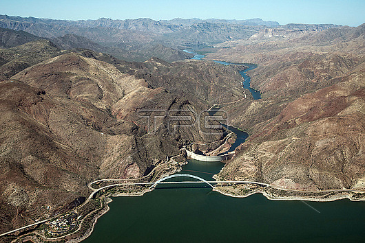
Aerial photograph of Theodore Roosevelt Lake, bridge, dam, and the Salt River in the canyons below. This lake is in Tonto National Forest and mostly in Gila County, Arizona, USA. The Salt River is the largest tributary of the Gila River. Aerial support by LightHawk.
| px | px | dpi | = | cm | x | cm | = | MB |
Details
Creative#:
TOP28464258
Source:
達志影像
Authorization Type:
RM
Release Information:
須由TPG 完整授權
Model Release:
N/A
Property Release:
N/A
Right to Privacy:
No
Same folder images:
 Loading