
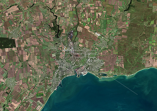
Colour satellite image of Mariupol, Ukraine. Mariupol is a city of regional significance in south eastern Ukraine, situated on the north coast of the Sea of Azov. The territory covered is 50 km x 35 km. Image collected on September 10, 2021 by Sentinel-2 satellites.
| px | px | dpi | = | cm | x | cm | = | MB |
Details
Creative#:
TOP28927237
Source:
達志影像
Authorization Type:
RM
Release Information:
須由TPG 完整授權
Model Release:
n/a
Property Release:
n/a
Right to Privacy:
No
Same folder images:
 Loading