
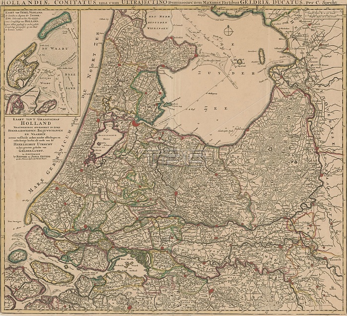
Map of Holland, Utrecht and a part of Gelderland, Kaart van 't graafschap Holland naauwkeurig afgebeelt in zyne heemraadschappen, baljuwschappen en waarden (...) / Hollandiae comitatus una cum Ultrajectino dominio nec non maximis partibus Geldriae ducatus (title on object), Map of the county of Holland, the manor of Utrecht and the greater part of the duchy of Gelderland. Top left an inset map of Texel and Vlieland. Below that the Dutch title. Top right two scale bars: German mylen 15 in a degreet; French mylen 20 in a degreet. Degree divisions along the edges. print maker: Caspar Specht, (possibly), publisher: Reinier Ottens (I) & Josua, (mentioned on object), print maker: Utrecht, publisher: Amsterdam, 1704 and/or 1726 - 1727, paper, engraving, height 526 mm x width 582 mm.
| px | px | dpi | = | cm | x | cm | = | MB |
Details
Creative#:
TOP28937984
Source:
達志影像
Authorization Type:
RM
Release Information:
須由TPG 完整授權
Model Release:
No
Property Release:
No
Right to Privacy:
No
Same folder images:
 Loading