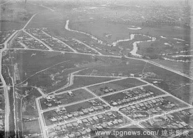
EditorialGlass Negative - Aerial View of Suburbs, circa 1940s, A black and white, half plate negative featuring an aerial view of suburbs and creeks possibly Coburg.
EditorialGlass Negative - Aerial View of Suburbs, circa 1940s, A black and white, half plate negative featuring an aerial view of suburbs and creeks possibly Coburg.
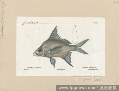
EditorialGerres plumieri, Print, The striped mojarra (Eugerres plumieri) is a demersal fish found in the western Atlantic, from North Carolina south along the U.S. coast, in the Gulf of Mexico, in the Caribbean from Cuba to Puerto Rico, and along the Central an...
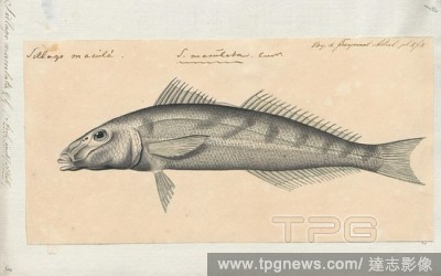
EditorialSillago maculata, Print, The trumpeter whiting, Sillago maculata, (also known as the winter whiting or diver whiting) is a common species of coastal marine fish of the smelt-whiting family, Sillaginidae. The trumpeter whiting is endemic to Australia, i...
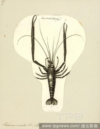
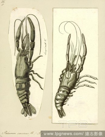
EditorialPalaemon ornatus, Print, Macrobrachium carcinus is a species of freshwater shrimp native to streams, rivers and creeks from Florida to southern Brazil. It is the largest known species of Neotropical freshwater prawn, growing up to 30 centimetres (12 in...
EditorialPalaemon carcinus, Print, Macrobrachium carcinus is a species of freshwater shrimp native to streams, rivers and creeks from Florida to southern Brazil. It is the largest known species of Neotropical freshwater prawn, growing up to 30 centimetres (12 i...
EditorialAmbassis nalua, Print, Ambassis nalua, the scalloped glassfish or scalloped perchlet, is a species of fish in the genus Ambassis. It is native to the Indo-Pacific region, form India to Australia and New Guinea, where it occurs in bays, estuaries and ma...
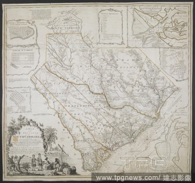
EditorialA Map of the Province of South Carolina. A MAP of the PROVINCE of SOUTH CAROLINA with all the Rivers, Creeks, Bays, Inletts, Islands, INLAND NAVIGATION, Soundings, Time of High Water on the Sea Coast, Roads, Marshes, Ferrys, Bridges, Swamps, Parishes C...
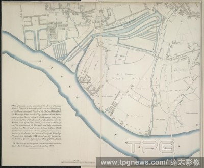
EditorialPlan of lands. 1827. Plan of lands in the vicinity of the River Thames between Pimlico, Chelsea Hospital and the penitentiary at Millbank, showing the Creeks of the Chelsea Water Works... Originally published/produced in 1827. . Source: Maps.Crace.10.23.
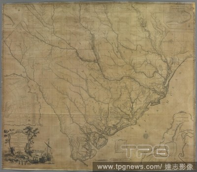
EditorialA map of South Carolina. A MAP of SOUTH CAROLINA. With all the Islands, Marshes, Swamps, Bays, Rivers, Creeks, Inland Navigations, And all the COUNTYS, DISTRICTS, TOWNS, ROADS, COUNTY, PARISH, and PROVINCIAL LINES; From an ACTUAL SURVEY. [London] : Pub...


 Loading