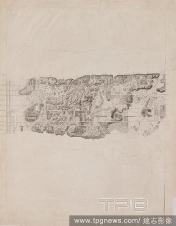
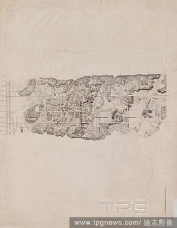
EditorialTopographical Map of the City and County of New-York and the Adjacent Country, 1836?ca. 1858, Engraving with additions in wash and black chalk, sheet: 33 1/4 x 25 3/8 in. (84.5 x 64.5 cm), Prints, Cartographer David H. Burr (American, active 19th centu...
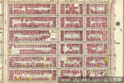
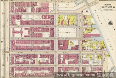
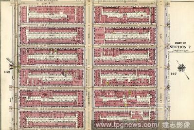
EditorialPlate 152: Bounded by W. 139th Street, Fifth Avenue, E. 138th Street, Harlem River Madison Avenue, E. 135th Street, Park Avenue, E. 133rd Street, W. 133rd Street and Lenox Avenue.
EditorialTopographical Map of the City and County of New-York and the Adjacent Country, 1836?ca. 1858, Engraving with additions in wash and black chalk, sheet: 33 1/4 x 25 3/8 in. (84.5 x 64.5 cm), Prints, Cartographer David H. Burr (American, active 19th centu...
EditorialPlate 152: Bounded by W. 139th Street, Fifth Avenue, E. 138th Street, Harlem River Madison Avenue, E. 135th Street, Park Avenue, E. 133rd Street, W. 133rd Street and Lenox Avenue.


 Loading