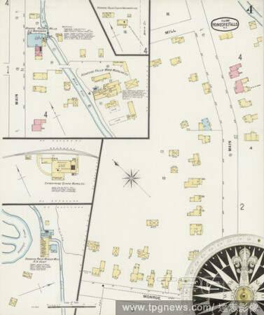
EditorialImage 4 of Sanborn Fire Insurance Map from Honeoye Falls, Monroe County, New York. Feb 1897. 4 Sheet(s), America, street map with a Nineteenth Century compass.
EditorialImage 1 of Sanborn Fire Insurance Map from Honeoye Falls, Monroe County, New York. Feb 1897. 4 Sheet(s), America, street map with a Nineteenth Century compass.
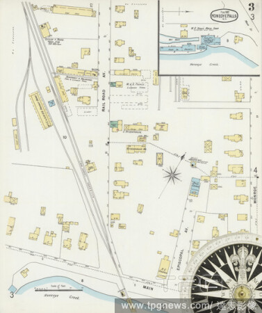
EditorialImage 3 of Sanborn Fire Insurance Map from Honeoye Falls, Monroe County, New York. Feb 1897. 4 Sheet(s), America, street map with a Nineteenth Century compass.
EditorialImage 2 of Sanborn Fire Insurance Map from Honeoye Falls, Monroe County, New York. May 1884. 2 Sheet(s), America, street map with a Nineteenth Century compass.
EditorialImage 1 of Sanborn Fire Insurance Map from Honeoye Falls, Monroe County, New York. Jan 1890. 4 Sheet(s), America, street map with a Nineteenth Century compass.
EditorialImage 1 of Sanborn Fire Insurance Map from Honeoye Falls, Monroe County, New York. May 1884. 2 Sheet(s), America, street map with a Nineteenth Century compass.
EditorialImage 3 of Sanborn Fire Insurance Map from Honeoye Falls, Monroe County, New York. Jan 1890. 4 Sheet(s), America, street map with a Nineteenth Century compass.
EditorialImage 4 of Sanborn Fire Insurance Map from Honeoye Falls, Monroe County, New York. Jan 1890. 4 Sheet(s), America, street map with a Nineteenth Century compass.
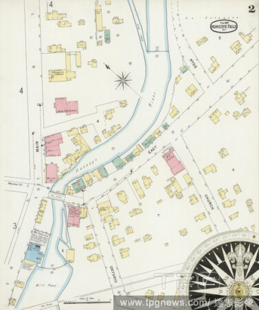
EditorialImage 2 of Sanborn Fire Insurance Map from Honeoye Falls, Monroe County, New York. Feb 1897. 4 Sheet(s), America, street map with a Nineteenth Century compass.
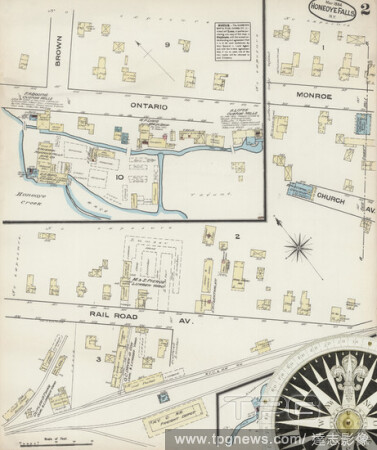
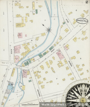
EditorialImage 2 of Sanborn Fire Insurance Map from Honeoye Falls, Monroe County, New York. Jan 1890. 4 Sheet(s), America, street map with a Nineteenth Century compass.
EditorialThomas Cole, American, 1801-1848, Honeoye Lake, from Richmond Hill, Ontario County, between 1801 and 1848, graphite pencil on off-white wove paper, Sheet: 4 3/4 ? 7 5/8 inches (12.1 ? 19.4 cm).


 Loading