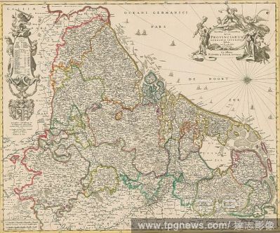
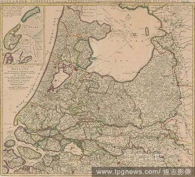
EditorialA map of New Belgium. An inset view of New York at lower right, known as the "Restitutio" and celebrating the restoration of New Amsterdam to Holland in 1673 . TOTIUS NEOBELGII NOVA ET ACCURATISSIMA TABULA. Amstelodami [Amsterdam] : Apud REINIER & IOSH...
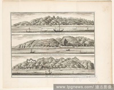
EditorialVarious reinforcements of the VOC on Ceram, La?la by Compagnies Sagoe-bosch / Loehoe, and the Fortres Overburg / The village of Saway (title on object), Sheet with three coastal views with reinforcements of the VOC on the island of Ceram in the Molucca...
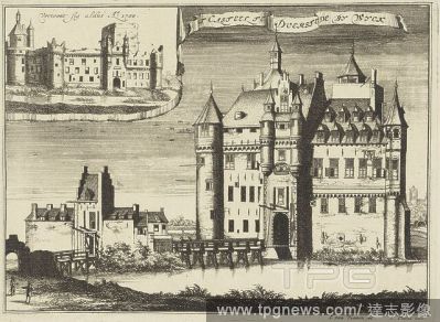
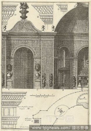
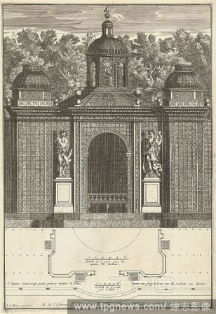
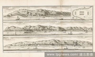
EditorialThree fortresses in the Moluccas, The Beverwyk fortress on the island of Noesa-Laoet, with the Sila and Leynitoe villages / Plan of the Duurstede Fortress / De Fortres Duurstede on the island of Honimoa / Haroeko, and the Fortress Zeelandia (title on o...
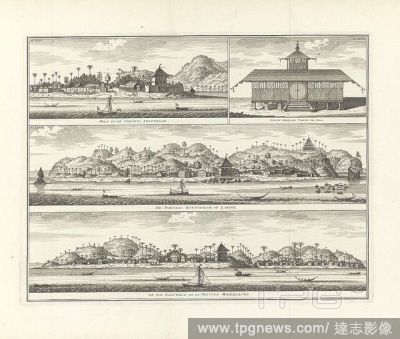
EditorialThree fortresses on Ambon Hila, and Fortres Amsterdam / New Moorish Temple of Hila / De Fortres Rotterdam on Larike / De Pas Baguwala and the Fortress Middelburg (title on object), Sheet with three coastal views fortresses of the VOC and an image of a ...
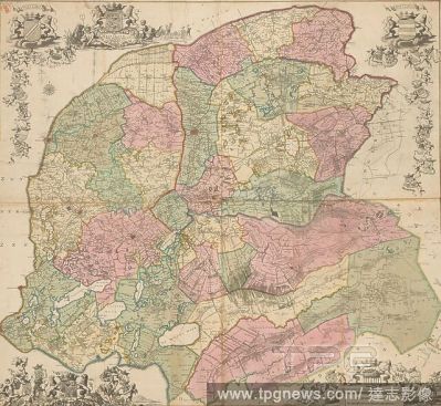
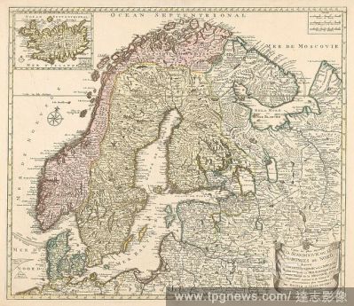
EditorialCartography in the 18th century, Scandinavia with 1 map of Iceland, Map of Scandinavia, colored by country, bordered in yellow, map of Iceland l.b. Turned north slightly to the right, l.m. wind rose. R.b. scale in Swedish, Danish-German and French mile...
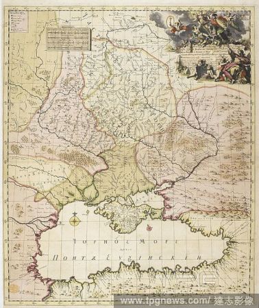
EditorialA map dated from 1745 - before the partitions of Poland. This map shows the western borders of "Velikaia Rossiia" (Great Russia). The map shows the borders with the Polish-Lithuanian Commonwealth and the Ottoman empire. Nouvelle Carte de la petite Tart...
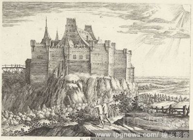
EditorialA view of the Strait of Gibraltar from the East, with the Rock of Gibraltar, Tarifa, Europa Point, Punta Carnero, Devil's Tower and Guard's Tower on the right, Ceuta, Morocco, Moorish Camp, Monkey's Mountain, Pasha's House and the coast of Tangier on t...
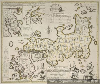
EditorialA map of the Kingdom of Japan divided into sixty eight provinces. Separate maps of Kamschatka and Niphon. Het Koninkryk Japan verdeelt in acht en zestig Provintien. [With separate maps of] Kamschatka [and] Niphon. Amsterdam : R. et J. Ottens, [1740?]. ...
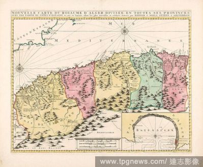
EditorialCartography in the Netherlands, map of Algeria with 1 side map, Map of Algeria, yellow bordered, areas colored, with one side map: map of the Bay of Algeria, here the compass rose is turned over (North is O.). Two compass roses on the map itself. Mount...
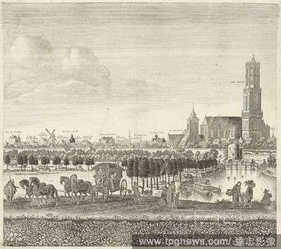
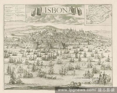
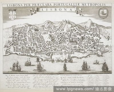
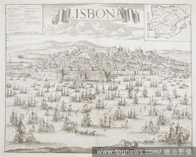
EditorialA panoramic bird's-eye-view of Lisbon from the Tagus River with sailing ships near the harbour in the foreground, and the city spreading at the feet of the citadel and the Castle of S?o Jorge on a hilltop in the background. LISBONA PER PR?CLARA PORTU...
EditorialView of Lisbon from the Tagus River, with Dutch and English fleets approaching the harbour, where a triumphal arch has been erected to welcome Charles of Austria. Crowds of spectators line the streets and watch in the squares, while cannons salute from...
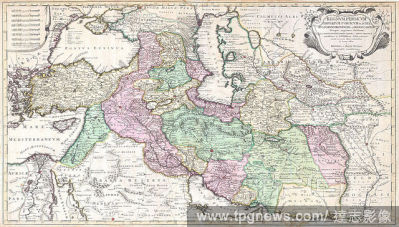
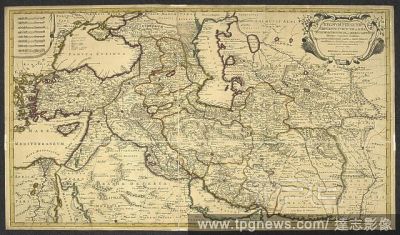
EditorialAn 18th century map covering Persia. Regnum Persicum, Imperium Turcicum in Asia, Russorum Provinciae ad Mare Caspium aliaeque regiones finitimae item Ponti Euxini, Maris Caspii ac Sinus Persici novissimae ac fidelissimae delineationes ... a R. et J. Ot...
EditorialA map of New Belgium. An inset view of New York at lower right, known as the "Restitutio" and celebrating the restoration of New Amsterdam to Holland in 1673 . TOTIUS NEOBELGII NOVA ET ACCURATISSIMA TABULA. Amstelodami [Amsterdam] : Apud REINIER & IOSH...
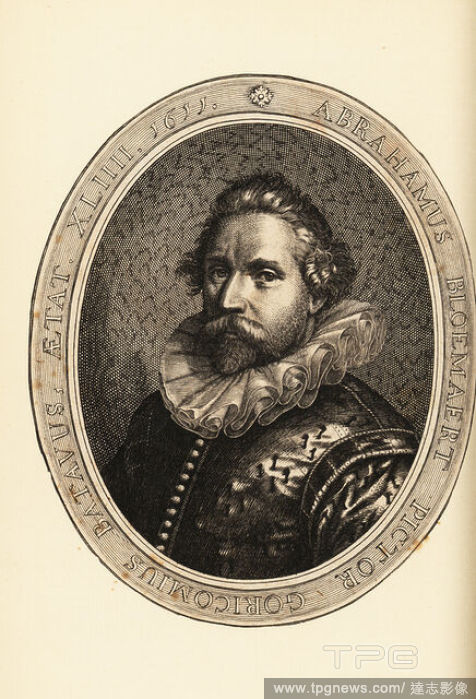
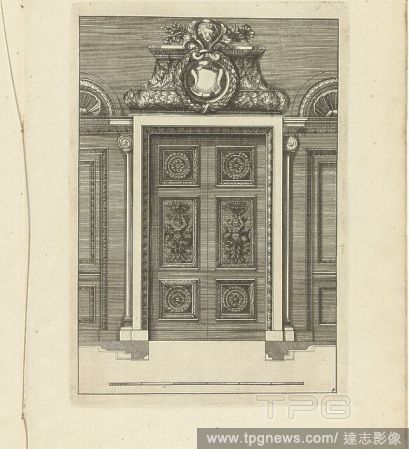
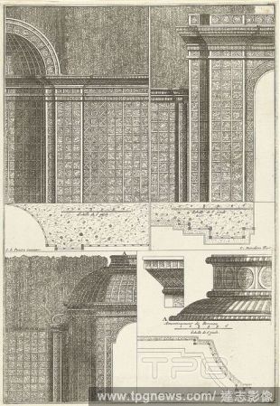
EditorialFrederik Ottens, River god in a landscape, Frederik Ottens (Dutch, active 171770), After Antonio Rossi (Italian, Bologna 17001753 Bologna), 1725, Etching, Sheet (Trimmed): 17 3/8 ? 12 11/16 in. (44.1 ? 32.3 cm), Prints.
EditorialA panoramic bird's-eye-view of Lisbon from the Tagus River with sailing ships near the harbour in the foreground, and the city spreading at the feet of the citadel and the Castle of S?o Jorge on a hilltop in the background. LISBONA PER PR?CLARA PORTU...


 Loading